Showing posts with label EM47. Show all posts

Sunday, March 6, 2022

More activity from EM47

Several HAMs from wide area between Fort Wayne, Chicago, Saint Louis and Huntsville became active during the MAD (Microwave Activity Day) on Saturday March 5. The main idea behind this activity was to make some QSOs on the 3456MHz band before recent FCC changes force us to move down in frequency to 3400MHz. Some of us combined this with activity on 10GHz and even other VHF+ bands. 

The SLAMS group also participated - Harry WA0CNS went to High Ridge EM48rl, Herbert AF4JF went South to EM47ow and Zack W9SZ was in EN50ue. The guys we tried to work were K9PW, K9JK, W8BYA, KV4PC and others. Unfortunately, the weather was warm but very windy. Way too windy. It complicated setting up the antennas big time. My (AF4JF) tripod with 10GHz dish got kicked over by wind gusts twice. I ended up holding it with one hand for 2+ hours. No way to set up my other bands (1296, 2304 and 3456MHz) that we wanted to play with. 

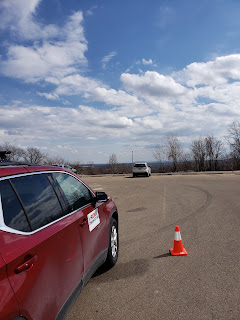
The EM47 location near Potosi, MO is on a hilltop (a windy hilltop), wide open to nearly all directions, with a big parking lot on the top of the hill. I have had to move around that parking lot between attempts on QSOs to get unobstructed view in the desired direction, but generally that location turned out to be very good. Even better, it is about 100km South from St. Louis, which makes it very interesting for QSOs with the guys in the "4" land. 

I have tried 10GHz with several stations mentioned above, but only succeeded with Gedas W8BYA - we managed to make a RS contact over 577km between AF4JF in EM47 and W8BYA in EN70. Funny was that we achieved that through "backscatter" on a rain cell over Cedar Rapids, Iowa! That cell was nowhere close to the direct line between us ... a nice proof that EVERYTHING is possible on the 10GHz band!

Several pictures attached.


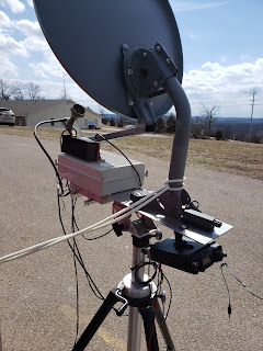
See the white rope that keeps the dish from tipping over in the wind?


Aiming North to work W8BYA over RS on 10GHz


Looking South towards the "4" land


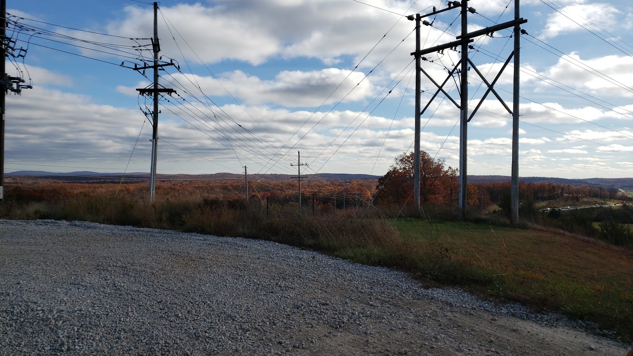
Looking North towards Saint Louis / Chicago / Cedar Rapids


Looking Southeast (I had to move a little while trying with KV4PC)

Saturday, November 13, 2021

Explorer Trip to Taum Sauk Mountain in EM47

Herbert AF4JF, Ron KO0Z and Harry WA0CNS took a trip to the highest mountain in Missouri, Taum Sauk 1772ft (540m) South of Saint Louis. Herbert's dog Darcey came along to make sure everything was done safely. The main idea behind this trip was looking for suitable microwave locations in the EM47 grid. We didn't do this alone, several guys living South of Missouri were waiting for us on other hilltops, ready for QSO on 1296MHz and 10GHz (KV4PC, K4QF, KD4APP, AB4DX, NV4B, W4RXR, KD4GRD, AG4V and WG8S).

Our first stop was the Taum Sauk mountain top (the national park) itself. We have been there before, so this was easy. As expected, found a nice viewing platform open towards Saint Louis and little East of it:

This is approx. azimuth 60 deg.


We should be able to work Zack W9SZ or Gedas W8BYA from this location on 10GHz too, but some propagation enhancement will be needed for that.

Darcey was very patient today

However, we didn't find any location open towards South to try with our friends from the "4" land. Next stop was the MDC fire tower just outside of the national park:


Unfortunately, the upper platform was locked by a solid lock. It was very windy up there, so we gave up the idea of setting up on the stairway and continued to our next destination, the Taum Sauk water power plant. We have seen several pictures of the upper reservoir others published on the Internet just weeks ago, so we didn't expect any problem there. We were wrong ...


Ameren badge is required to get past that gate

The lower reservoir is easily accessible, but the upper one is not. All the street signs that pointed us to the "Ameren Upper Reservoir" got us just to a visitor center. Looks like visitors can register for a guided tour, but not drive anywhere up the hill and play radio ... The guy working at the visitor center suggested a back road across the nearest hill to try - we were still trying to find a spot open towards South and the guys waiting for us. Unfortunately, we didn't find any open spots. Just hills and trees and bushes and more hills and ... you got the idea.

We tried to explore some of the hills around (they were all called "mountain" for some reason), but no luck. Other local guy whom we stopped told us that there are some open spots on their tops, but these are only accessible through hiking trails, not by a car. After another hour of trying and trying, we gave up, called the waiting guys on a phone and decided to find something to eat.

Waiting for lunch at Mexican restaurant in Potosi

Finally something worked! We have found a Mexican restaurant with good food. Ate that and got started on our way back towards Saint Louis. Big surprise just minutes from the restaurant - we found a good open microwave location, still in EM47! There are two nearby parking lots that offer nearly full 360 degrees open view. Attached pictures show the direction towards Southeast:

Direction towards SE


EM47OW, 321m a.s.l.

This location isn't the highest and is little bit closer to Saint Louis, but the distance is still almost 100km. Besides, it is in EM47 which is different grid (St. Louis area is in EM48). We definitely will come back to this location next time and try again.

So, the trip wasn't a total failure after all, despite the fact that we didn't even set up any station today. Herbert's microwave equipment just made a round trip in the back of the car. We returned back home before 5:00pm, about 10 hours after leaving this morning. Big thanks to all the guys waiting for us in the "4" land!